| It being 2nd of July
there was no room at the inn in Seward so we camped about 20 miles out on
the way to Whittier. | 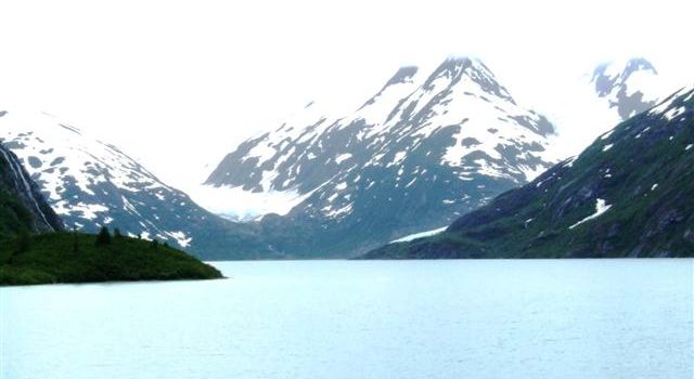 |
 |
Just outside Whittier we find the Burns Glacier, the more famous Portage
Glacier is in the valley to the right. The glacial meltwater forms the lake.
The visitor centre is built on the glacial moraine and was named after two
US Senators who were lost in a plane crash in this area. |
| The glacier has been
retreating since the 1900s and now can no longer be seen from the visitor
centre. | 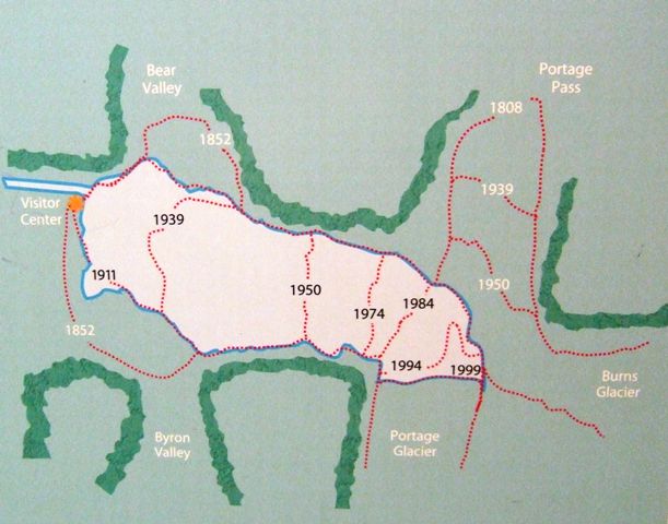 |
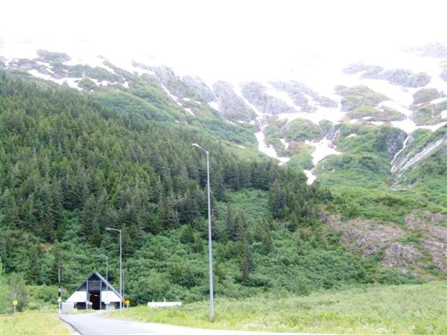 |
Until 1979 Whittier could only be accessed by boat or rail. Then the rail
tunnel was paved between the rails to allow road traffic to pass through. |
| It is 2.5 miles long and
traffic is allowed through for 15 minutes in each hour in each direction
unless a train is scheduled. | 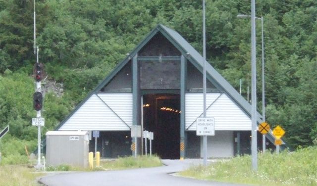 |
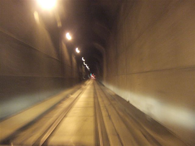 |
Speed is limited to 25mph and it is quite narrow although tall enough for
the dual high railway panorama cars... |
| We were lucky because as
we exited the tunnel, a train was lining up to traverse the tunnel north. |  |
 |
Whittier is another port of call for the cruise ships which come up from the
lower 48. |
| There isn't anything at
Whittier except the location which is spectacular. |  |
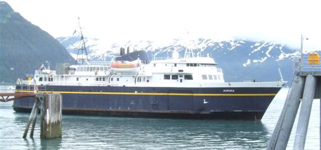 |
We were there to catch the ferry to Valdez. This was expensive but did
replace nearly 350 miles driving This is the 1200ton car ferry Aurora |
| This puzzled us. It is a
train ferry but we don't know where it travels between. | 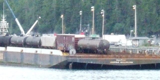 |
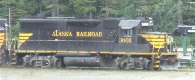 |
The engines of the Alaska Railroad are now blue and yellow. These are in the
much older black and yellow. |
| We think most of the
freight comes in to Alaska by sea in containers through this port. The
Buckner building in the background is now empty. When it was built it was
the largest building in Alaska.. | 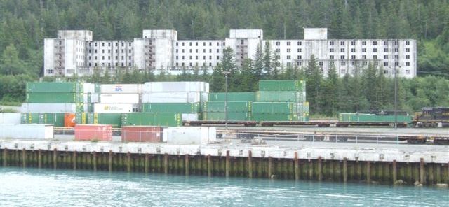 |
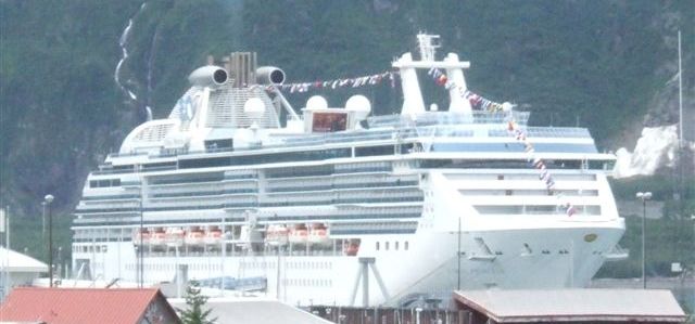 |
A last shot of the cruise ship as we depart. We suspect that this was also
about to leave. |
| Out in the bay we found
another one. This one is Japanese and probably has come from Japan which is
not actually any further than the lower 48. |  |
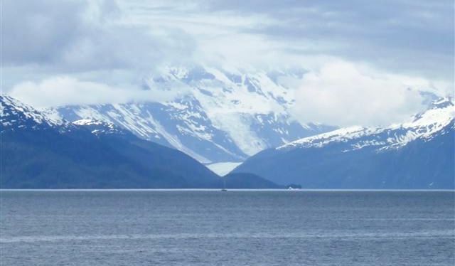 |
The boat journey to Valdez takes almost 8 hours. It takes about 35 cars and
was not full. There was a National Forest ranger on board to guide us. The
glacier in the V is the Harriman Glacier. |
| We must have passed a
dozen glaciers but it must be a tidewater glacier just around the corner
from the number of icebergs here which have calved from it. | 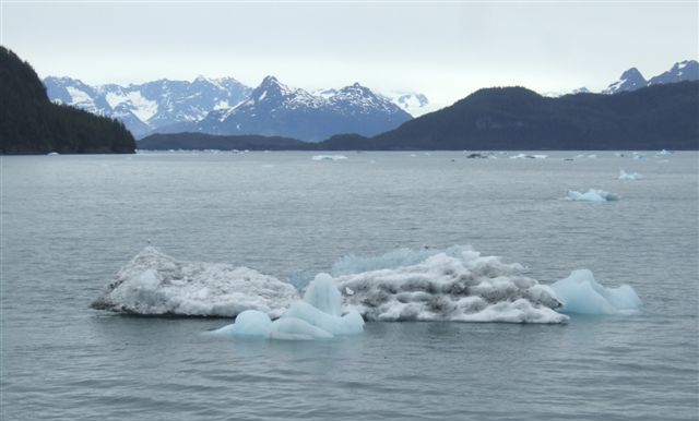 |
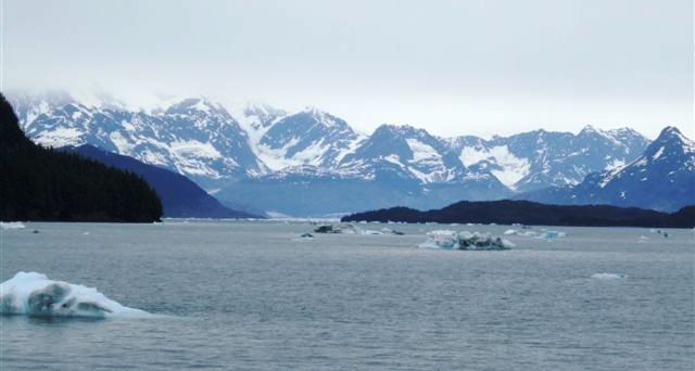 |
This particular bay conceals one of the largest glaciers on the coastline |
| This is a local seine net
fishing vessel travelling back to Valdez. | 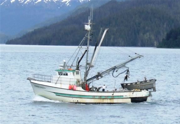 |
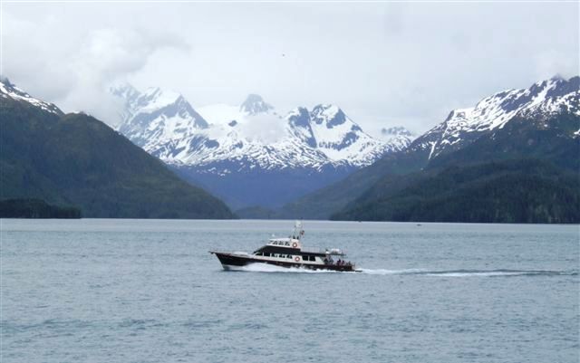 |
I thought this was a pilot boat for the tankers but it turned out to be one
of the tour boats racing to get home. |
| A seine netter bringing
in the net. Nearby another boat was just deploying its own net. | 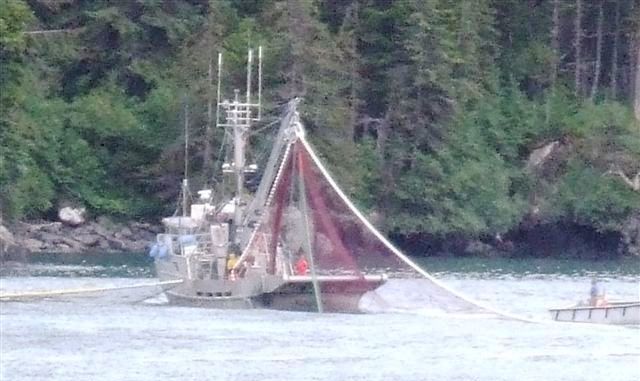 |
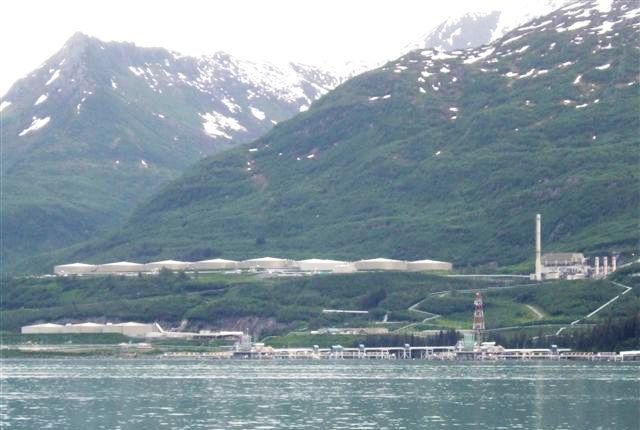 |
The oil terminal on the opposite bank at Valdez. This is the southern end of
the Alaska pipeline. We saw no tankers. The pipeline is currently pumping
750,000 barrels per day, well down from its capacity of 1.9million. |
| Inside the car ferry. We
were the largest vehicle on board but not the only RV. | 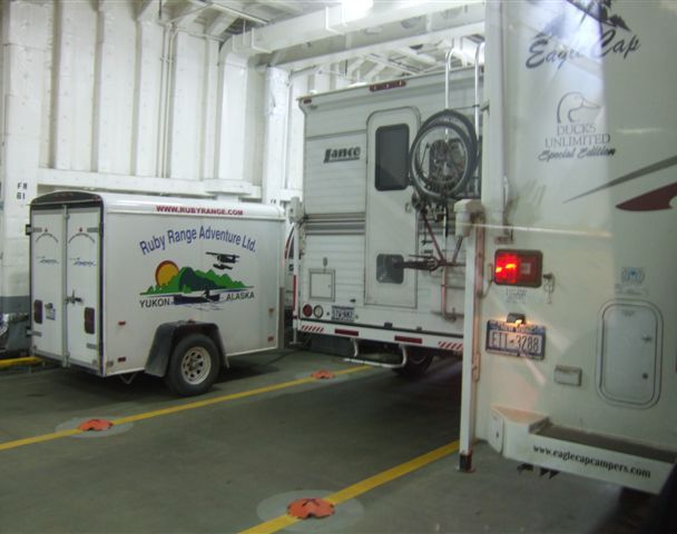 |
|