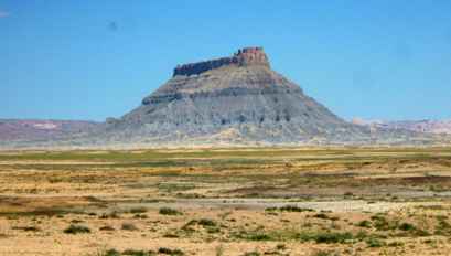
| We stayed in the land of vast edifice cliffs although the colours
changed again as we headed westwards. The camera doesn't really give you any idea
of the scale here either. |  |
 |
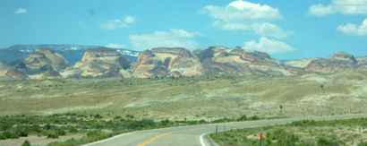
This photograph gives a little more scale but this 'pile' is 20 miles away
and it is flat barren desert between us and it. |
| Then as we crested a climb we saw stretching out in front of us
the most amazing set of colours I've ever seen on a set of mountains. | 
|
 |
There were reds and blues and purples mixed in with greens and yellows. But
the reds were quite different to those we had seen surrounding the Colorado
River. This was Capitol Reef National Park. The road cuts through a narrow
neck but the park stretches over 100 miles north to south without any roads
at all. |
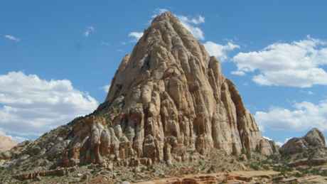
| Some of the rocks just stick up like giants' teeth, the result of
some cataclysmic event at some point in the ancient past. |
 |
 | This valley
had been settled by a few Mormon families and a some reminders remain like
this dwelling house which once housed a family of ten. And that door is not
six feet high. |
| There was also a preserved one room schoolhouse and this
blacksmith's shop. We didn't visit as the area was overrun by schoolkids at
the time. The area was actually called Fruita probably after the fruit
orchards which were planted here and still remain today. The area is now
maintained by the Parks Service. | 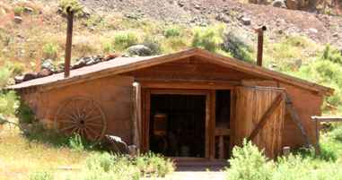 |
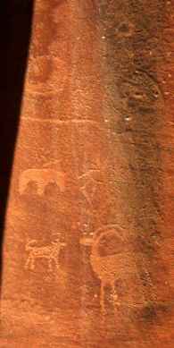 |
At the side of the road was a cliff which contained a number of petroglyphs
which are thought to have been put there by antecedents of the native tribes
(possibly Hopi) which also lived in this area. These were not easy to see
and have been damaged in the more recent past by graffitti. |
| There is a nine mile 'out and back' drive through one of the
canyons. We were advised that it would be fine with our 32ft RV but
they forgot to tell us about the dry river crossings (washes) which caused
us to ground several times. Although the river is dry it can be subject to
flash flooding which leaves a white salt residue adding to the coloration. |  |
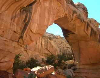 |
Elsewhere in the park was another 'natural bridge' at the end of a two mile
hike. This was also quite hard to see until you were almost under it, but
spectacular none the less. There was also a nine mile hike to the valley rim
but the two miles was exhausting enough for me in the continuing heat. |
| On the way back we spotted this 'pothole' arch where the erosion
has taken place in both planes (often by different mechanisms). These are
equally spectacular if not having the same gross dimensions (the Americans
love statistics). This one was full of tiny lizards scurrying everywhere. |  |
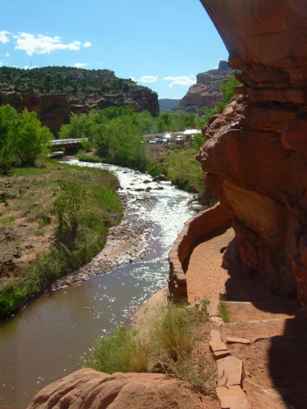 |
Finally we made it back to the river which flows alongside the road and as
the time was moving on you get some amazing colours and shades. |
|
Our final call as we passed out of the canyon to our campsite on the other
side at Torrey was of this massive set of cliffs. Actually you needed to see
the full 360° panorama but the still camera
doesn't capture that well. | 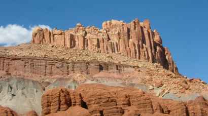 |
|